


Lidar & ROV Biodiversity Mapping
Category

Investment Required
Funding advanced environmental telemetry
Projected Return
Backed by carbon validation grants
Overview
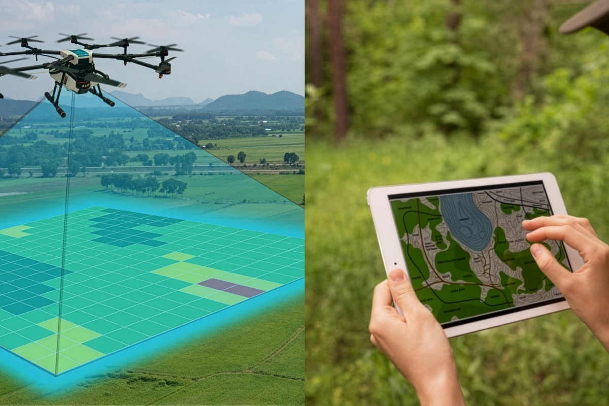
A high-tech environmental telemetry and data analytics initiative engineered to map Vanuatu’s natural capital assets with absolute precision. By deploying terrestrial Lidar-equipped drone swarms and deep-sea Remote Operated Vehicles (ROVs), this program builds a high-resolution digital twin of the archipelago's forest canopies and marine ecosystems, establishing an empirical framework for targeted ecological protection and immediate conservation interventions.
Why We Do It
Modern climate policy and international carbon credit registries demand verifiable, high-fidelity data, yet remote island ecosystems frequently suffer from critical data blind spots that expose them to environmental and economic exploitation. We eliminate these structural information gaps by deploying a sophisticated territorial scanning engine, transforming undocumented biodiversity into verified ecological assets that attract international climate financing while protecting native territorial sovereignty.
How It Works
The project operates a continuous scientific pipeline that converts raw spatial telemetry into globally validated, audit-ready conservation metrics.
Sourcing
High-resolution spatial data, structural canopy density, and deep-reef marine baselines are continuously captured using autonomous drones and robotic oceanic ROVs across high-priority ecological zones.
Access
International research institutions, carbon registries, and global conservation agencies secure streamlined access to the database for verified, real-time ecosystem telemetry.
Distribution
Processed topographic models and biodiversity index charts are distributed directly to local councils and global partners, enabling highly precise, data-backed land-management decisions.
Impact Indicators
Data Precision
100%
High-fidelity ecosystem tracking achieved
Mapping Reach
5,000 Hectares
Terrestrial and marine zones scanned
Asset Valuation
Verified
Empirical carbon metrics established
Scientific & Community Governance
The Biodiversity Mapping network operates completely within a community-led development framework, ensuring that all spatial maps, environmental data sets, and territorial insights remain the exclusive intellectual property of local village councils.
Simultaneously, The Lab acts as the primary computational processing hub for this raw telemetry, interpreting Lidar and ROV outputs to provide immediate agricultural optimization data to our Food Independence plots and precise climate-risk modeling to our Water & Energy teams.
Map the Future with Us
Partner with Flavor Islands to finance the deployment of advanced ecological telemetry and build the definitive scientific foundation for Pacific island resilience.